

Join
Programs
About


TGP’s Digital Twin connects BIM, CAD, reality capture, drone imagery, IoT and construction data within a shared geospatial environment. Built on ArcGIS, it transforms fragmented project information into accessible, connected intelligence, helping more than 300 users across 18+ departments improve collaboration, consistency, speed and decision-making throughout project delivery.

Large infrastructure projects generate enormous volumes of information across BIM, CAD, surveys, terrestrial laser scans, drone imagery, orthophotos, meshes, point clouds, schedules and field systems. At TGP, these datasets were valuable individually, but they were produced by different teams, updated at different times and accessed through different applications. The result was a familiar construction challenge: people could spend significant time locating the right information, confirming whether it was current, and understanding how one dataset related spatially to another.
The challenge was not simply to create a 3D model. It was to create a practical digital environment that connected design, existing conditions, construction progress and operational information in a way that non-specialists could use. Data also needed to remain useful at multiple scales, from an overall project view to a specific building, BIM element, drone flight or field location.
The team therefore focused on reducing information silos and creating a consistent spatial context for decision-making. The objective was to make complex engineering and construction information easier to find, compare and interpret without requiring every user to become an expert in source software or data format. That foundation also needed to work with existing authoring and project systems rather than replace them.
The solution was developed by starting with real project workflows rather than with a technology-first definition of a digital twin. The team identified where staff were already using BIM, CAD, drone data, terrestrial laser scanning, imagery and operational information, then designed GIS applications that made those existing workflows easier and more connected.
Working with Esri Canada, TGP is using ArcGIS as the geospatial foundation for this connected environment. A central GIS Hub became the entry point to the digital environment. From there, users can move into purpose-built applications depending on the task. Reality Mapping brings together terrestrial laser-scan and drone-derived data with oriented imagery, meshes, point clouds and BIM. Building Explorer places BIM and building footprints in their real-world context and allows users to understand design information alongside surrounding conditions.
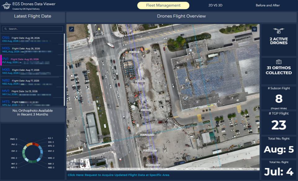
Drone Data Viewer supports flight and data management, while 2D-versus-3D and Before-and-After tools help teams compare orthophotos, reality meshes, point clouds and BIM and review construction progress over time. Operational data can also be connected through APIs and viewed in dashboards, while XR extends the same project context into immersive review.
This incremental approach allowed the team to develop the Digital Twin around recognizable project needs, improving adoption while creating a scalable framework for additional data and workflows.


