

Join
Programs
About


Geospatial Digital Delivery for GO Expansion: Connecting GIS, BIM and 3D Across the Corridor

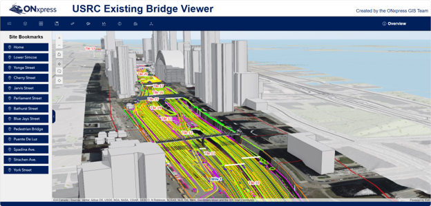
ONxpress created a connected digital delivery environment using ArcGIS Enterprise, BIM, reality capture and immersive 3D visualization to link design, field and project information across GO Expansion. The approach enables earlier conflict identification, real-time field inspections, faster decision-making and a trusted information foundation that can be transferred to the owner.
GO Expansion represents an extraordinary information-management challenge. The program spans an active regional rail network and brings together civil infrastructure, track, utilities, structures, signalling, electrification, environmental information and existing assets across hundreds of kilometres of corridor.
Information needed to make decisions originates from many disciplines, organizations and systems. Traditional project delivery methods can make it difficult for teams to understand how individual designs, investigations and construction activities relate to one another geographically. A drawing, model, spreadsheet or report may be accurate on its own, but project teams also need to understand where it applies, what surrounds it, what has changed and who else may be affected.
For ONxpress, the challenge was therefore larger than creating individual digital models. It was creating a shared spatial context that could connect information across disciplines and make a project of this scale understandable to a much broader group of users.
The approach needed to work with existing engineering and BIM processes rather than replace them, while supporting design coordination, field activities, visualization, decision-making and ultimately the development of a project-wide 3D digital twin.


